9.1 The data zone boundaries of the SPD areas are shown in Maps 3 to 6. The populations of the SPD areas were built up from the General Register Office for Scotland’s mid-2006 local authority and data zone populations. Data zones are the standard small area geography used by the Scottish Government. In general they have populations of between 500 and 1,000 residents. Data zone boundaries do not exactly match SDP boundaries and so, for the purpose of the projections, data zones are included or excluded based on the ‘population weighted centroid’, as determined by the Scottish Government and explained below.
9.2 ‘Population weighted centroids’ are a standard procedure for assigning the population of a small geography to a large geography if the small geography does not wholly fit within the boundaries of the large geography or lies across the border of two large geographies. The population weighted centroid is essentially the point in the area where population density is the same all around the point. In this case, a data zone will be allocated to the SDP area if the population weighted centroid lies within it.
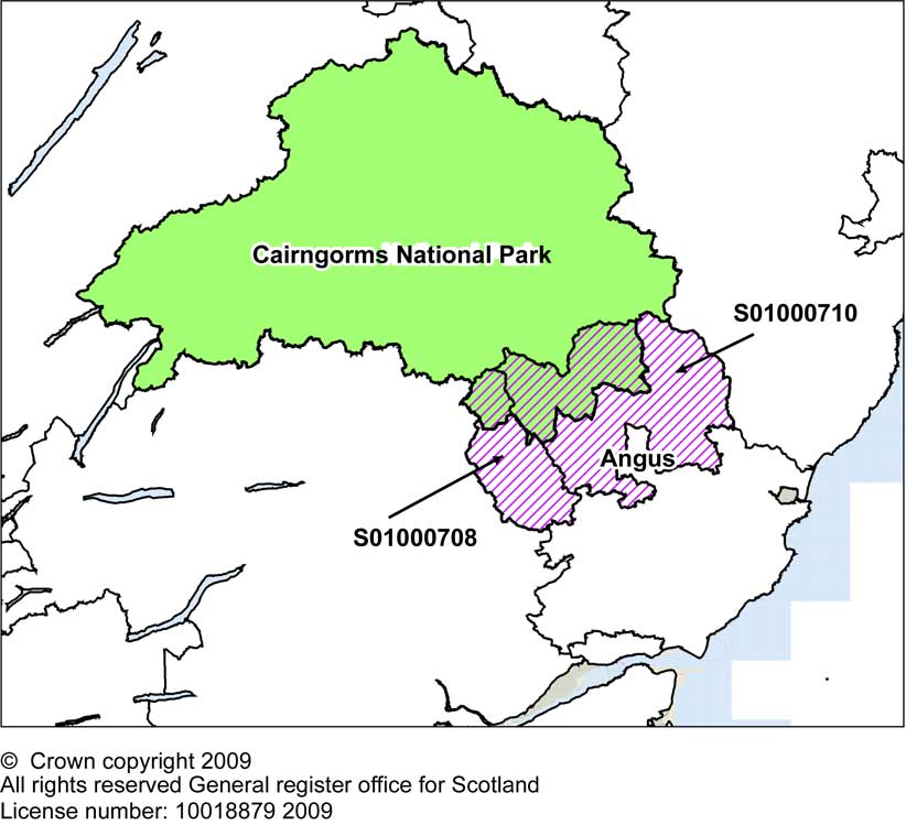
9.3 For example, in the TAYplan SDP area, there are two data zones in Angus Council (S01000708 and S01000710) that overlap the Cairngorms National Park. However, this overlap with the National Park forms only part of these two data zones and the majority of the population for these data zones actually sit within Angus Council rather than the National Park, (see Map 2). Therefore these data zones have been included in the SDP area projection and not in the National Park projection. Thus in practice, the population of the whole of Angus Council area is included in the projections for TAYplan SDP area. Similar circumstances occur for the small part of Perth & Kinross Council area that lies within with the Loch Lomond and Trossachs National Park.
Map 2: Data zones in Cairngorms National Park and Angus Council
9.4 A list of the data zones used to split Aberdeenshire, West Dunbartonshire and Fife into the appropriate SDP areas for these projections can be found in Annex A.
Map 3: The location of Glasgow & Clyde Valley SDP area and the constituent local authorities
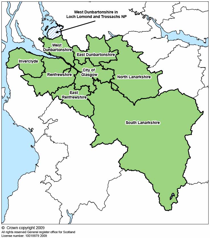
Please note that this map shows data zone boundaries used in the projections, rather than actual SDP boundaries.
Map 4: The location of Aberdeen City & Shire SDP area and the constituent local authorities
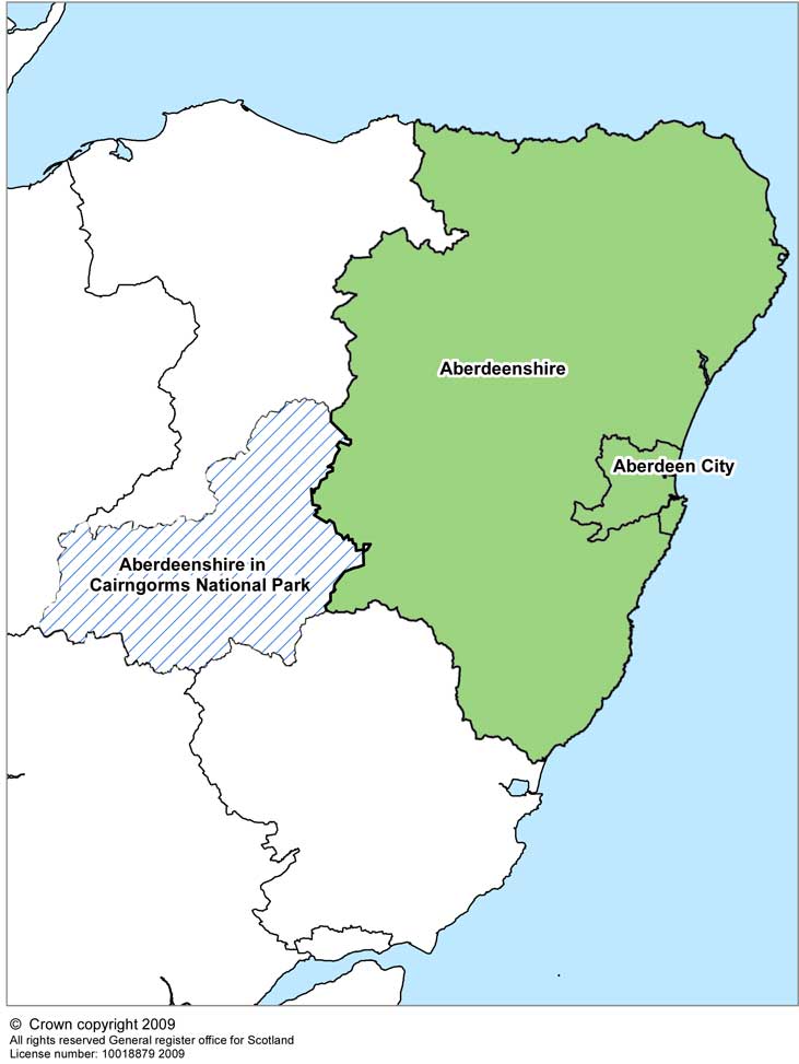
Please note that this map shows data zone boundaries used in the projections, rather than actual SDP boundaries.
Map 5: The location of SESplan SDP area and the constituent local authorities
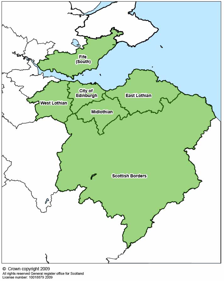
Please note that this map shows data zone boundaries used in the projections, rather than actual SDP boundaries.
Map 6: The location of TAYplan SDP area and the constituent local authorities
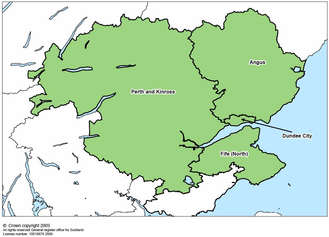
Please note that this map shows data zone boundaries used in the projections, rather than actual SDP boundaries.