1.1 This report gives the General Register Office for Scotland’s forward projection of the population and number of households in Scotland’s Strategic Development Planning (SDP) areas. The forward projections are given up to the year 2031, based on the estimated population of the SDP areas in mid-2006. The projections are trend-based and are not, therefore, policy-based forecasts.
1.2 This is the first set of population and household projections produced by the General Register Office for Scotland for the SDP areas. Previously, projections have been produced for local authority areas, and projections for Scotland’s two National Parks were published for the first time in October 2008.
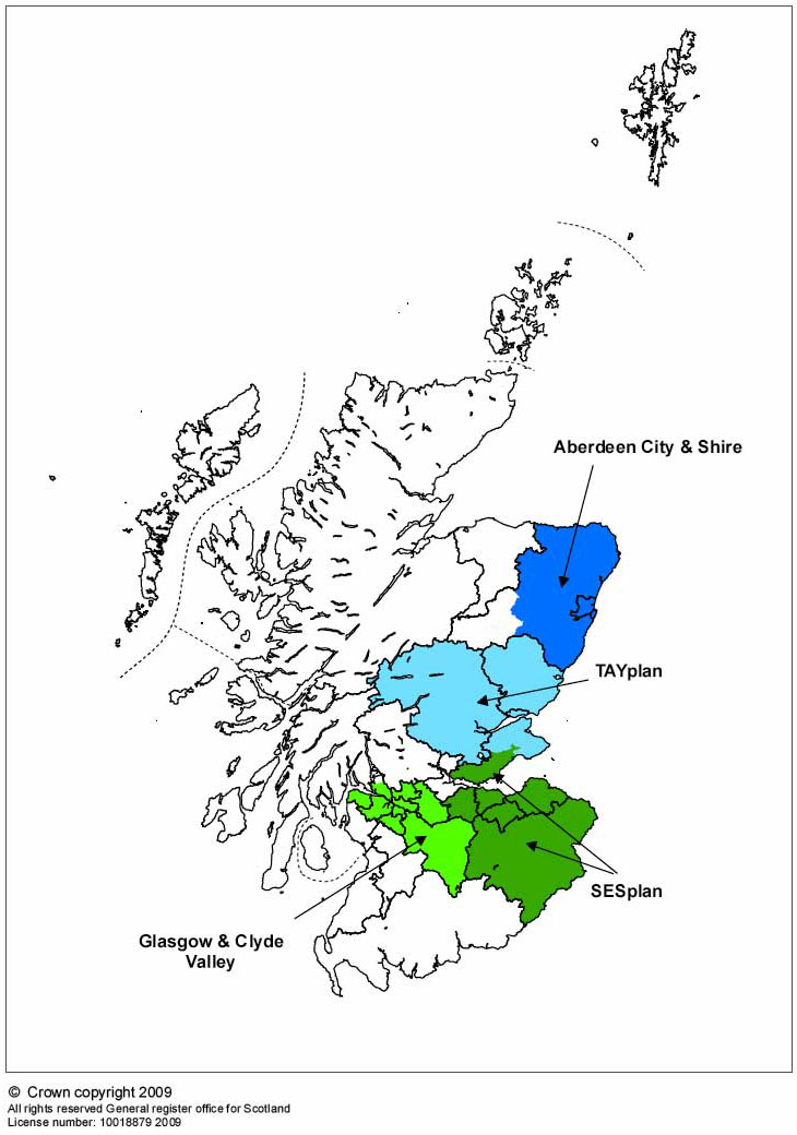
1.3 SDP areas (see Map 1) cover the four largest city regions around Aberdeen, Dundee, Edinburgh and Glasgow. Three quarters of the population of Scotland live in these areas. In November 2008 the following SDP areas were agreed by Ministers:
Glasgow and the Clyde Valley Development Plan Area (Glasgow & Clyde Valley SDP area)
East Dunbartonshire, East Renfrewshire, Glasgow City, Inverclyde, North Lanarkshire, Renfrewshire, South Lanarkshire and West Dunbartonshire (excepting the part of West Dunbartonshire that forms part of the Loch Lomond & the Trossachs National Park).
Aberdeen City and Shire Development Plan Area (Aberdeen City & Shire SDP area)
Aberdeen City and Aberdeenshire (excepting the part of Aberdeenshire that forms part of the Cairngorms National Park).
Edinburgh and South East Scotland Development Plan Area (SESplan SDP area)
City of Edinburgh, East Lothian, Midlothian, Scottish Borders, West Lothian and Fife (Kirkcaldy, Mid Fife and Dunfermline local planning areas only).
Dundee, Perth, Angus and North Fife Development Plan Area (TAYplan SDP area)
Angus (excepting the part of Angus that forms part of the Cairngorms
National Park), Dundee City, Perth & Kinross (excepting the part of Perth & Kinross that forms part of the Loch Lomond & the Trossachs National Park) and Fife (St Andrews and North Fife local planning areas only).
1.4 Summary information on the population and number of households in SDP areas can be seen in Table A.
Table A: Total populations and households in SDP areas in 2006
| Population |
Households |
Percentage of Scotland total |
||
|---|---|---|---|---|
| Population |
Households |
|||
| Glasgow & Clyde Valley |
1,746,890 |
785,440 |
34% |
34% |
| Aberdeen City & Shire |
440,020 |
198,020 |
9% |
9% |
| SESplan |
1,192,300 |
532,280 |
23% |
23% |
| TAYplan |
469,880 |
212,130 |
9% |
9% |
| Rest of Scotland |
1,267,810 |
563,550 |
25% |
25% |
| Scotland |
5,116,900 |
2,291,420 |
100% |
100% |
These figures were revised slightly
in November 2009.
For more information see the page http://www.nrscotland.gov.uk/statistics-and-data/statistics/statistics-by-theme/housholds/household-projections/archive/2006-based-sdp-areas
1.5 Further details of SDP boundaries are given in Section 9 and Maps 3 to 6 . More information about SDP areas is available from the Scottish Government’s Planning Circular 3/08: http://www.scotland.gov.uk/Publications/2008/11/25145654/15 .
Map 1: Map of Scotland showing locations of SDP areas
Please note that this map shows data zone boundaries used in the projections, rather than actual SDP boundaries.